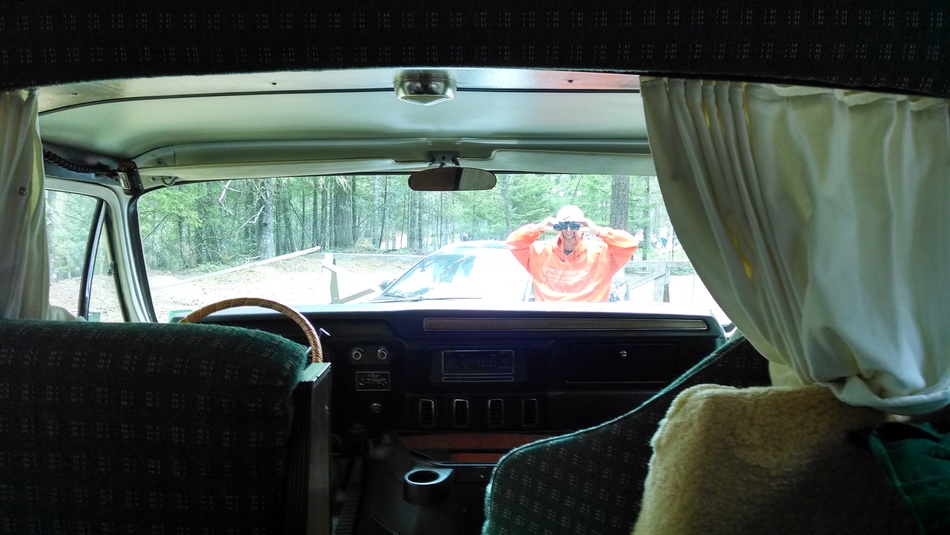
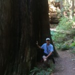
Not long ago I posted about the shabby and inconsiderate behavior of a few of the visitors to Mt. Constitution. We call them voyeurs
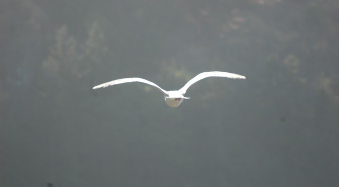
Binoculars!? REALLY?!! Sheesh!
because of their tendency to ignore the privacy boundaries we’ve erected around the summit host campsite.
Two very good friends from the world of full-time RVing got in touch after reading that post, and offered to send us some wonderful screening material that had served them well for years. While it won’t prevent dweebs from stolling all around our rig,
Like privacy glass when it’s in place. Wow!
it will at the very least, prevent them from seeing through our windshield.
Less glare, and clear viewing.
The stuff is called RV-QuickShades , and it arrived today. It is a UV protective fabric that reduces heat and sunlight damage inside the rig, while blocking visibility from outside. Yet, it permits clear viewing from inside our rolling home, looking out.
Of course, we will still have people milling beyond the signs and saw-horses we’ve deployed asking for a patch to call our own for our weeks here at Mt. Constitution, but our dear friend, Kendra, had a good suggestion for THAT problem. I can’t wait to try it:
$7/100 ft roll, at Amazon, and free shipping with Prime.
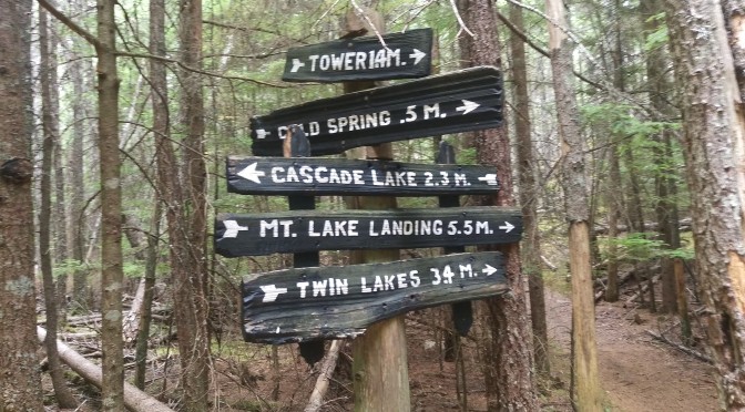
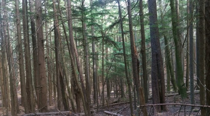
Yesterday’s hike was a 1200 foot descent from Mt. Constitution (elevation 2409 feet MSL), and thence a slow 700 foot ascent through old growth forest, climbing back up to the peak of Mt. Pickett (Elevation ~1750 feet MSL).
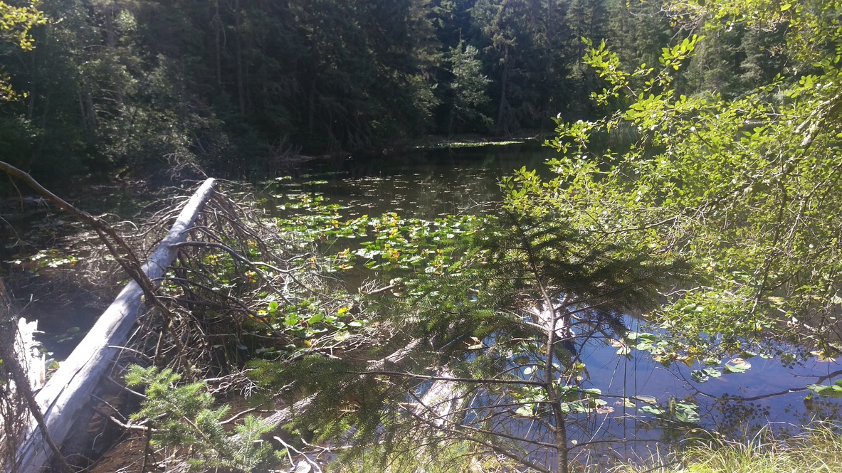
The eastern lobe of Twin Lakes bathed in sunshine. Happy newts abound there.
The Twin Lakes trail has become very familiar, with its initial rocky switch backs, crumbly with gravel sliding under our feet like ball-bearings. The footing, thankfully, improves for most of the climb down, but is steep enough to make your knees complain unless one shortens one’s stride quite a bit.
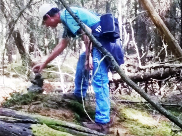
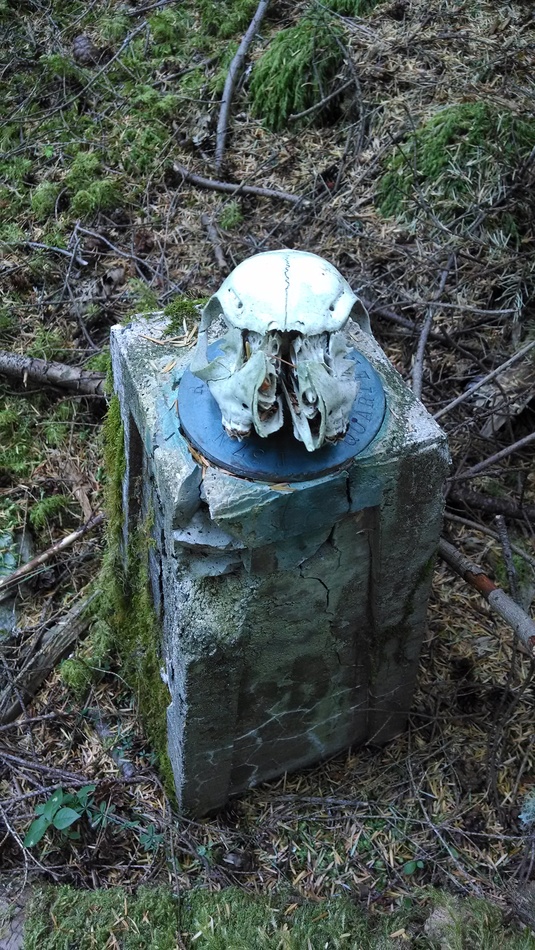
We added a stone to the cairn atop Mt. Pickett.A fragment of an old “whiskey” jug led us to a geodetic marker…
At the lakes, we turned to Mt. Pickett, and made our way up through the old growth forest. The plan was then to do the loop around the south arch, a long wooded loop that would have us returning by Mountain Lake, but we changed the plan when I spotted surveyors’ tape marking a new trail that turned east and north. It was exciting to explore this untraveled part of the park, not knowing exactly why it was marked, or where it was taking us. It led down the back side of Mt. Pickett, toward the shoreline, but ended suddenly below the last ridge lying between us and a very steep descent to the water.
We were at the last of the orange tape markers, when I noticed a black, shiny feature perched atop a fallen log about 20 feet to the right of the trail’s end. I climbed under some limbs, and on reaching it, discovered it was a fragment of a black, earthen jug, with spout and handle still intact. It was next to a geodetic marker, much lower to the ground and harder to see.
A close-up of the marker.
It was obviously placed there to make it easier to find the geodetic marker. The pink ribbons marking the trail went no further, and we concluded that it had been blazed to take a surveyor’s party back to that marker when needful.
With no further marked path to guide us, the obvious choice was to turn back, but we decided to climb that last ridge to see if there were any views out to the water. The ridge was steep, but with sound footing in soft mosses, and we were amply rewarded
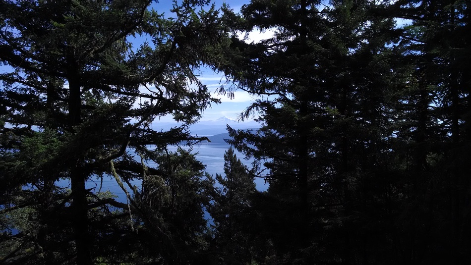
The eastern vista to Mt. Baker. Nice spot!
for our effort with a beautiful picnic site overlooking Barnes, Clark and Lummi Islands and the channels between them. It was time for lunch!
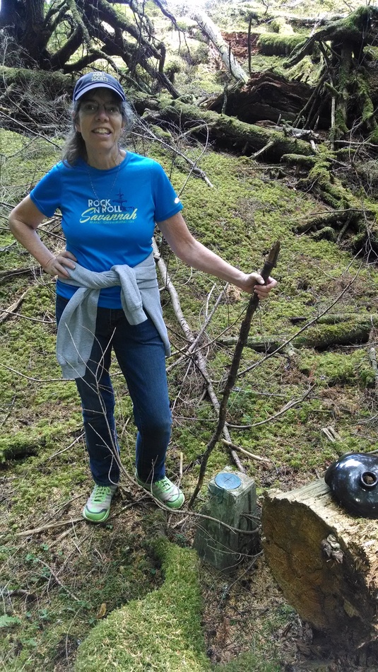
After sandwiches, trail mix and water, we retraced our steps, and returning to the geodetic marker, I placed an animal skull we’d found on top of it, to note our passing. The return trek was even more exciting, in that we decided to take a short cut off-trail over a ridge to intersect the road north and west of Mt. Pickett. This saved a repeat of the climb all the way to the top of that mountain, sparing energy for the climb back up Mt. Constitution.
We circled the eastern lake at Twin Lakes, to be able to say that we did, and Ann checked that off her list. Turning uphill, we made our slow way retracing the switch backs, back up to our camper. The 1200 foot Twin Lakes ascent (actually ANY ascent back up here) is a real cardiac workout. After a cup of soup, and with a book in hand, I conked out for about two hours.
I described our hike the next day to a young park ranger who became passionate about the terrain we had explored. It is an area of old growth and bluffs overlooking a part of the park that he would like to see opened. If a trail could be improved there, it could make accessible a small piece of shoreline which Moran State Park has retained on the Rosario strait facing Barnes Island.
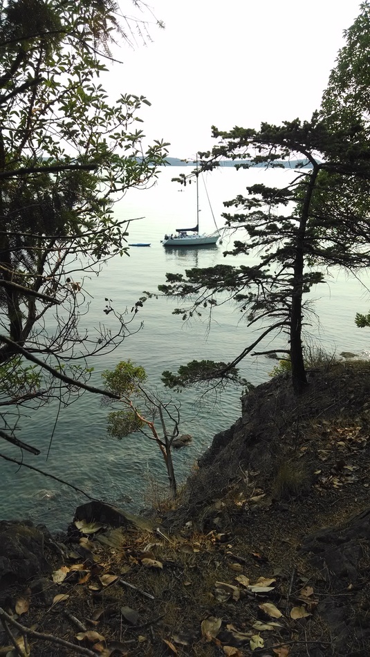
A sail craft moored at Obstruction Pass campgrounds.
He would like to see that become a rustic campground for backpackers, with marine access too, similar to the rustic campgrounds at Obstruction Pass State Park, a small marine-use sister park managed by the staff here at Moran State Park.
Would I be a volunteer host again? You betcha, and for a whole lot of reasons:
Elliott and I have learned to live in a smaller space, with all of our essentials. Do we need 3,000 square feet? Certainly not. Can we live in 95 square feet indefinitely? Um, no. Among other things, a somewhat larger shower would be nice, as would room for my sewing machine. And having room in the fridge for more than one chilled bottle of wine would be great, though not necessary. Elliott probably misses his computer tinkerings and all of its assorted pieces of equipment. If I were to do this full-time, I’d need two desks: one for my computer and one for my sewing machine. And yes, I like my creature comforts–though fewer of them than I had thought I needed.
Living isolated has taught us that it’s up to us to get out and move. I can’t rely on my running buddies (though I definitely miss them) to motivate me to run. I miss running–correction, I miss having run–and I’m not sure enough of my footing to go trail running. Hiking is a good alternative, and the uphills keep me huffing and puffing. I still need to make myself go out and hike–the lure of vegging out in front of the computer is strong–but the self-discipline is good. (I think I was a sloth in a previous life. In a warm climate. With plentiful food supply.)
It feels good to be a part of something bigger than ourselves. (This might be the royal we, as I haven’t really talked about this with Elliott.) Knowing that I can make a difference in every park visitor’s experience is motivation to keep that smile on my face, that “we’re glad you’re here” in my voice. (Though I will admit that’s not always true. There are those rare people who talk down to me as if I were a second-class peon whose only purpose is to fulfill their every park desire. See the vest? It says “volunteer,” not “walk all over me.”) Even picking up litter means that I’m making this bit of the world a little bit better.
Getting to know a park really well–and the other park volunteers–is rewarding. When someone asks me, “What’s this trail like?” I can reply with personal knowledge and maybe make their visit a little bit rewarding too. As a day-tripper, I could appreciate the scenery from an egotistical point of view (“I like this,” “I find this beautiful,” “I saw an eagle,” etc.) but I couldn’t share a lot about the park itself. Now I can. (And yes, that’s a do-loop of an egotistical point of view as well. I think it’s impossible to escape our ego, but not impossible to let it rule us.)
And speaking of ego, working in a not-very-well-funded state park means a lot of our focus is on making the park better, and not on ourselves, our experiences, our self-entitled worlds. Everyone here works to make the park a better place. It means some days I find myself plugging mouse holes with 2” circles of wood and a bit of glue, and other days I’m painting ceilings in the bathroom. It means combining Elliott’s trip into town with a stop at the shop to drill holes in the new “welcome, visitors” signs advertising free coffee and tea.
I’m thinking this has opened up a whole new world for us, one that I hope we’ll repeat. I’m not sure I’m ready to give up the sticks-and-bricks home that we’ve built–not yet, anyway–but it has definitely expanded our world.
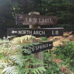
While Elliott and fellow volunteer Darlene were off consuming oysters yesterday (fresh, briny little buggers that he reports were delicious), I set off on a hike that was partly already-traversed territory (Summit to Twin Lakes and Cold Springs) and partly new (North Arch area).
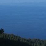
Despite being on a 57-square-mile island, the only long-range views of this loop were at the end of the hike. The ripples and currents in the water called for yet one more photo of an ever-changing landscape. These are the views that make you feel like a tiny speck of dust in a giant windstorm, a single mindless drop in an ocean of the same.
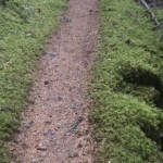
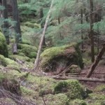
The rest of the hike was what I had expected when we decided to head to the Northwest: old trees, mossy landscapes, narrow paths. These views are the more close-in ones, the ones where you are just yet one more example of a
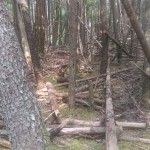
A mossy narrow path, with moss-covered stones on both sides of the trail.moss-covered stones cascading down to a narrow stream
vast landscape of beings and plants. As my hikes get further out from the tourist centers (the lakes, the tower), I encounter fewer people and more mysteries.
Mysteries like the circle of stones with a stone cross bisecting the
A circle of moss-covered, lichen-buried stones–and a big mystery
circle. Who put these rocks here? Why? When? And mysteries of the two burned trees about ten feet apart–but nothing else had burned near them. [A digression: Some native pine trees require burning to propagate. Unfortunately, controlled burns are discouraged here, for various reasons: There are old growth stands it would be a shame to lose. Some of the second-growth trees are some 150-200 feet tall, and fire would spread uphill rapidly. Fire breaks would be near impossible to create. Rather than even attempt a controlled burn, apparently the state legislature at some time in the past redefined “old growth” to include younger trees, thereby making it politically (environmentally, economically, legally) difficult to get public support for such an attempt. I wonder if it would be possible to select a few trees, cut them off at some lower defined height, station a dozen or so people with fire extinguishers around, and burn the stumps, giving Mother Nature its necessary burn but preserving the trees around them. Maybe? Who knows–not me.]
The edge of the square hole in the middle of Moran State Park
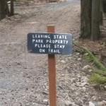
Part of this hike borders a 23-acre square “hole” in the middle of Moran State Park that is the site of a private antenna farm visible for miles around the area, from Vancouver in the north to the Olympic range in the south (including Mount Rainier). Signs on the trail warn you when you are leaving the park, discouraging unwanted visitors. Deer, however, have no compunction about disregarding the signs, and I spotted one drinking from a pond that was probably just inside the restricted area.
One of the reasons for these hikes is to stay in running shape. I’m not sure it’s working–I’m averaging about 30-minute miles, but I am getting aerobic workouts. Guess I’ll just have to wait and see how I do when I get back to the flatlands.
And a humorous addendum for all of you patient readers who have made it this far:
If I fart in the wilderness, does it make a sound?
Assuredly, yes. Mine must be like bull moose mating calls or something. I stop and listen to birdsong, squirrel noises, and leaves rustling, assuring myself I’m the only one there. But inevitably, as soon as I let loose, someone appears. Yesterday it was a trail runner coming from the switchback path above me. The hike before that, it was at a trail intersection I hadn’t known was there until I reached it–and saw the group of hikers silently parading by not fifteen feet from where I was–silently being the operative word, and which I was definitely not. Deadly is still under debate.
This is extremely embarrassing. I know part of it is due to a healthy (as in lots of beans and rice) diet, some is lactose intolerance, some is age, and some is, well, a lack of muscle control. Being new to this extravagant abundance of gas means that I’ve never figured out how to time such things or how to postpone them. They just happen.
But there is a plus side: If ever I fall off a cliff while hiking in Moran State Park, one toot and someone will arrive to summon the EMTs.
This post is a shout-out to others living as nomads, especially any of you who have done the volunteer park host, docent, or light house “keeper” thing:
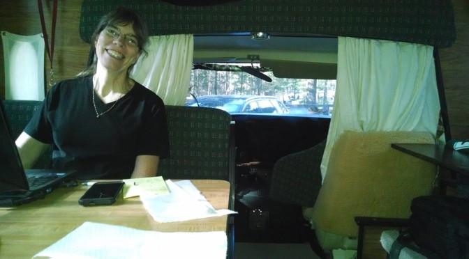
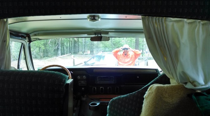
So, I glanced up the other day to see a guy with binoculars six feet in front of our motor home, smiling like a jack-o-lantern, and gazing in our front windscreen with his field glasses!
How do you deal with the curiosity of the public near your home? Ok, it’s a camp site, but home is home…is where you hang your hat… and where the heart is…AND, HEY, YOU! THIS IS WHERE I LIVE!! BEAT IT!!!!!
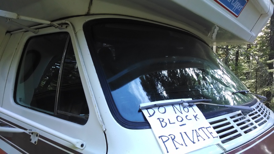
From the very first day here, some visitors to Mt. Constitution have had a tendency to wander all around our camp site, which is the one and only hook-up here. It’s a no-camping, day-use only part of the park, and we’ve got a little sign out there that reads, ‘SUMMIT HOSTS – ANN & ELLIOTT’. There are also saw-horses, and a polite sign which reads, ‘PLEASE DON’T BLOCK RV SITE’. Most people do “get it” that, “Hey, that must be a residency”, and they respect the boundary.
But for a certain kind of person, every boundary is a challenge to their special entitlement to violate it. The first few times these dweebs would really raise my hackles, but with the passing days here, I’m considerably more relaxed about it, if no less disgusted by these creeps. I’ve learned to see the humor in their absurd conceit. If I have “the drop” on them, it’s kind of fun to suddenly pop into view. Like ambush journalist Mike Wallace barging into the corrupt politician’s office, bang! There I am, all alligator smiles, asking, “Are you lost? Can I be of assistance?”.
In fairness, sometimes they really are just disoriented, and in dire need of the restroom. Those people I cheerfully help and guide along. But the voyeurs will blanch with shame: They’ve been caught peeping in your windows, and they know… that you know… what they were really up to…AND what they are. It’s kind of wonderful to see them stammer, “Uh, no, … good-bye.” And off they slink!
This little journey to Orcas Island, and experimenting with unemployment, early retirement, call it what you will, started without much planning. To say that the sudden decision to take three months of unpaid leave from my career was spontaneous is a major understatement. One minute, I was blithely puttering around the house, the next I was searching Craig’s List for a cheap motor home in the Pacific Northwest. How do these changes happen? Or perhaps better to ask, “Why?”.
We have met a number of people who live and travel full time over the past several years, and that life holds a certain allure for me. Many of these modern gypsies are in retirement, but not all. The young people who work and travel constantly are the most interesting of them. When it’s time to retire, it’s easy to think of selling the “farm” and hitting the road, but for younger people the point is that “farms” never held any appeal in the first place. Nomads don’t imagine that they should ever cling to one permanent home, but feel at home as they travel. They are “permanent transients”, to borrow Edward Albee’s phrase from ‘The Zoo Story’, but joyously so. They do bond and form communities, both with people fixed in space, but also with other nomads with whom they crisscross paths over and again. They’ve acquired skills that allow them to earn and be productive where ever they are.
My work is doctoring people’s eyes, and as such hasn’t lent itself to wandering off so. I did have earlier careers where frequent travel might have been the normal mode. I might have become an actor, or remained in the military, but those paths didn’t stick. Now I’m very close to setting the clinical work aside. Would I want to live constantly in 90+ square feet, caring for the vehicle and its “life support” systems, and thinking ahead to the next port of call, the next vista? Maybe… maybe not.
But whatever I learn, it will be from having sampled the nomad’s life for a time. It needed a leap from safety. A bungie-jump, if you will.
Three days a week–Tuesdays, Saturdays, and Sundays–it is my responsibility to pick up litter in the day use area down by Cascade Lake. This is a recent addition to my duties because two of the volunteer hosts had to leave for medical reasons, and so the remaining volunteers have divvied up all their tasks. Since I have to start my day at the gift shop on Tuesdays and at the learning center on Saturdays and Sundays at 11 a.m., that means I have to get down to Cascade Lake and back up here before that time–and it’s 4.3 or so miles each way, and normally takes four hours just to hike.
I could easily drive to the bottom–but we’re in a borrowed car and are trying not to kill its transmission by going up and down the steep road more often than once a week or so. So I’ve started hitching a ride with the ranger or park aide opening up here at 6:30 a.m., do my litter-picker-upper job, and hike back uphill via the Cold Springs Trail.
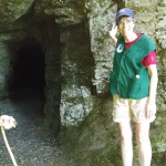
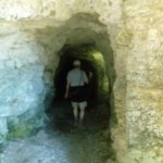
Yesterday, Elliott went with me–and since I didn’t have to work in the gift shop, we had all day to hike. We stopped on the way down at a couple of abandoned mine shafts, where someone had gruesomely placed a rabbit skull (Deer? Human?) on a stick at the entrance. Elliott bravely followed the shaft until it split in three directions and then opted to return to me, waiting at the entrance and ready to flee at any moment for help, life, or backup (depending on what he found). Near the bottom we also found what has to be one of the largest trees in the park, though the majority of them are to be found near Mount Pickett–a hike for a different day.
It takes about an hour to pick up litter at the beach, the parking lots, and the picnic areas. Although most people are considerate and dispose of their trash, there are sometimes those who simply leave their tables littered with used cups, paper plates, paper ice cream dishes, the remains of a dozen or so crabs, and so forth. Grrrr! Cigarette butts abound in the parking lot, presumably where someone waited for errant family members to arrive. The worst litter is the fruit sticker, since it gloms itself on to pavement, tables, grass, etc. Many people do stop me and thank me, and it does feel good to leave the area looking much better, so I guess I won’t complain too much about the few.
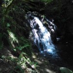
After dumping the litter in trash cans, we took the Cascade Loop trail to Cascade Falls, where there are actually four waterfalls: Rustic, Cavern, Cascade, and Hidden Falls, all found within about a half-mile of the trail. Cascade Falls is the tallest, at over 40 feet, and the highest in the San Juan Islands. During the course of our hike to Mountain Lake, the path followed the stream–and we found several other, unnamed but equally enchanting, waterfalls. We also found trail riders and a banana slug.
At that point, nearly nine miles into our hike, we called it quits and hitched a ride to the top with Gary, one of the park employees. Facing the last five miles–most of them a steep incline–on a by-now empty stomach was more than we could bear. Still, we’re well on our way to covering all 38 miles of hiking trails in Moran State Park.
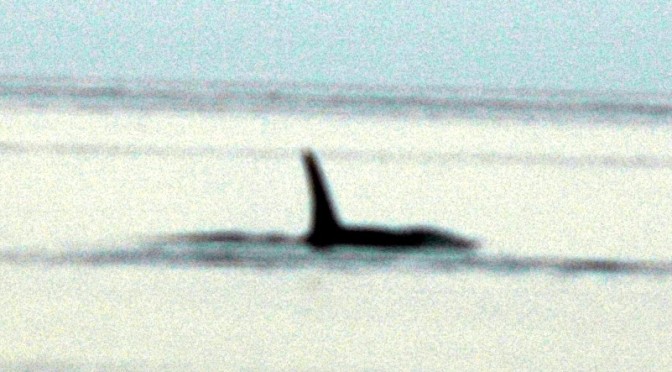
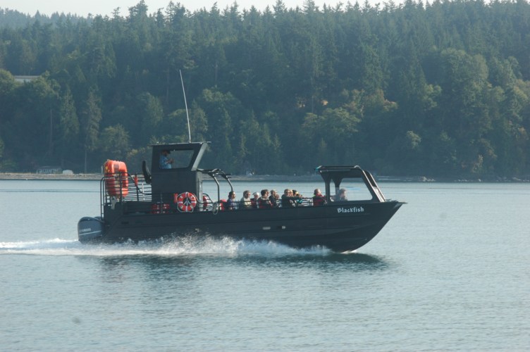
This was on Ann’s bucket list for our adventure as summit hosts here on Orcas Island. I was encouraging her to go, but hanging back for my own part at the expense. Then we found a hefty online discount for a tour boat out of North Beach, conveniently close to East Sound just below Moran State Park. It was such a good discount that we were a bit leery, but Outer Island Expeditions proved to be very capable, with fast comfortable boats and enthusiastic, well informed guides.
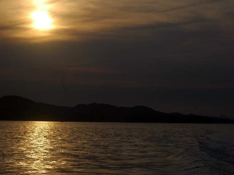
After the safety briefing, we were divided into two groups, and boarded onto some VERY fast boats. We were on our way, streaking north into Canadian waters. Our sister craft was smaller, lighter, and a bit faster, and took off ahead of us. Our craft had a larger group, and better shelter from the elements, which we greatly appreciated on the return run, chasing the sunset.
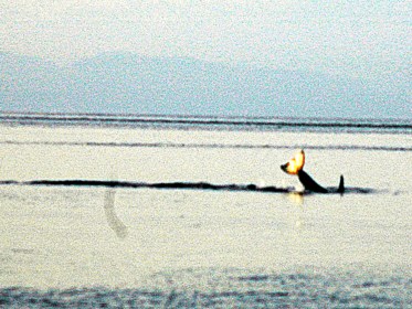
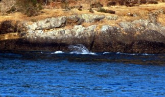
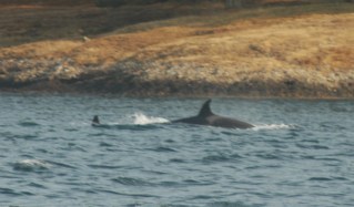
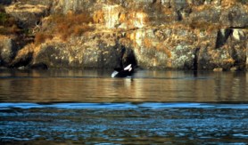
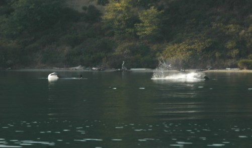
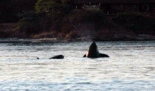
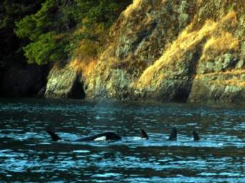
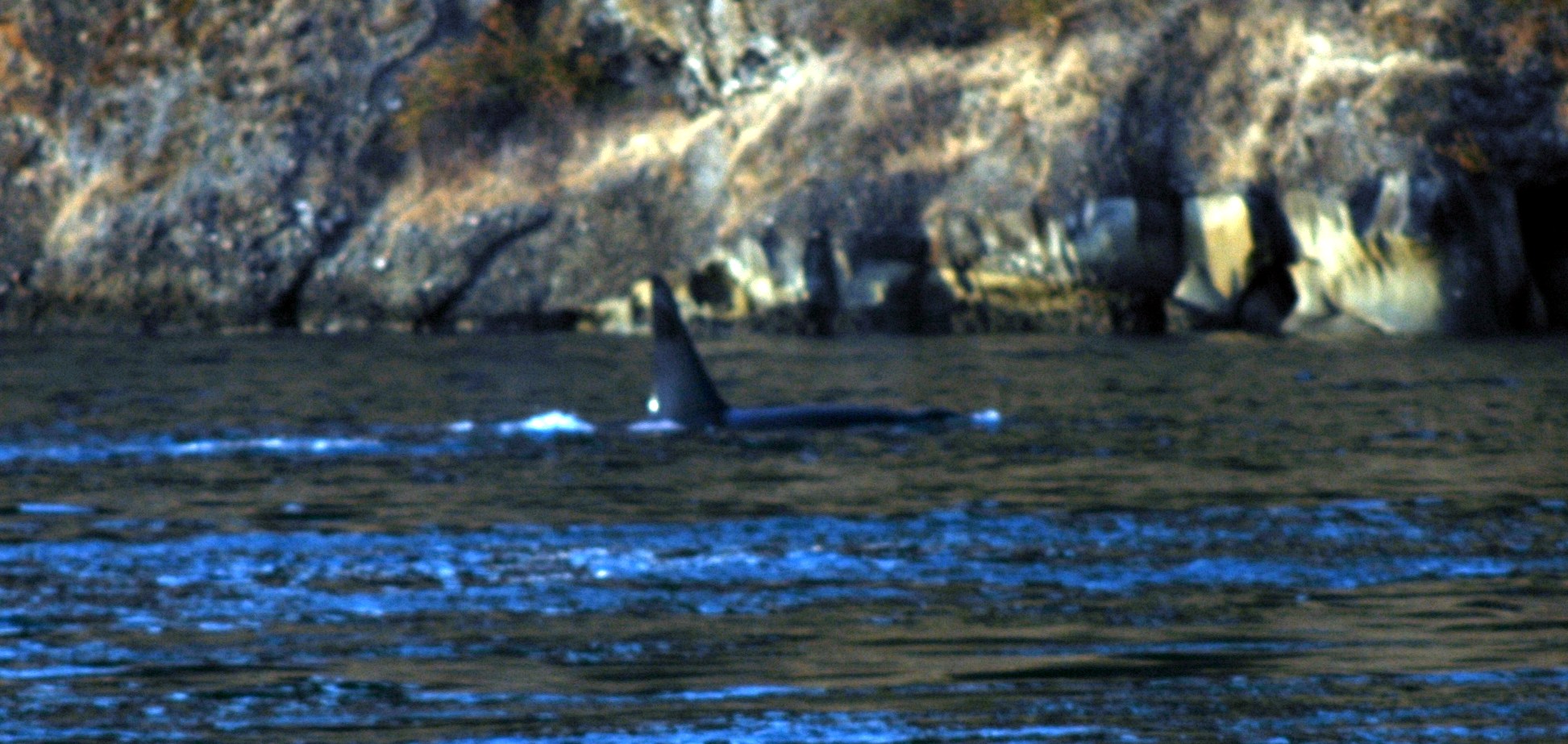
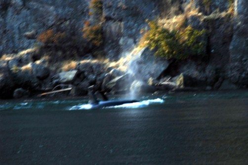
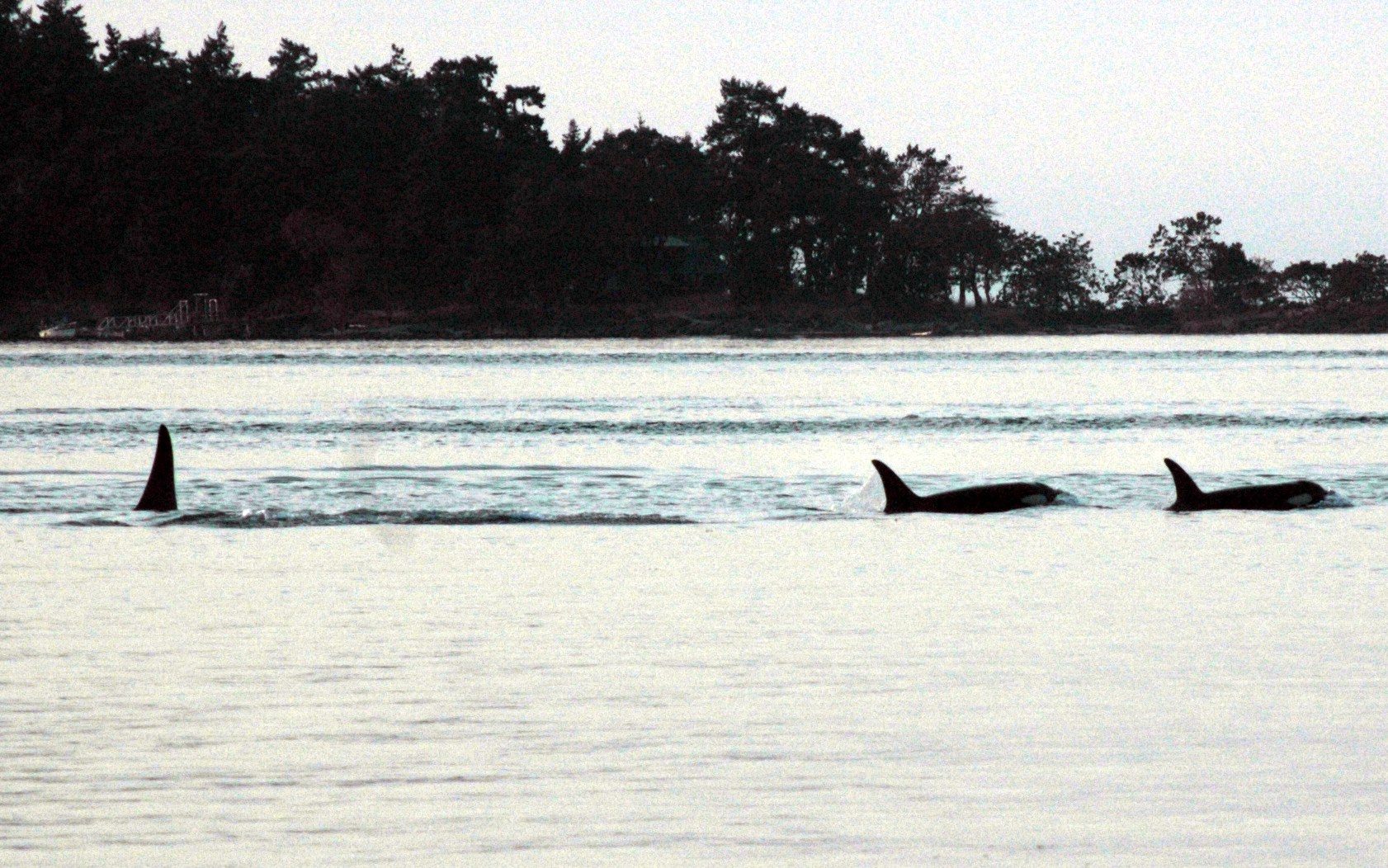
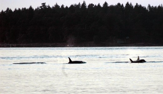
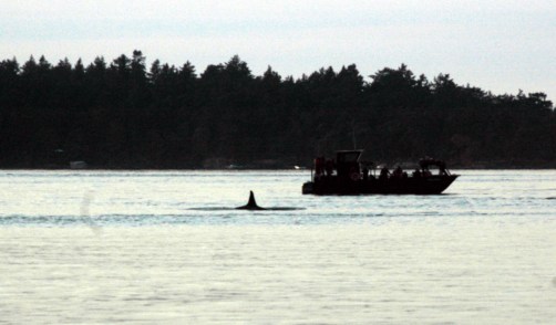
We saw many, many orcas whales in the island channels, but also some lovely lighthouses, and a number of interesting ships. A Canadian destroyer was working its way south past us, as well as several British Columbia ferries. The whale watching traffic kept a respectful distance from the pods of orcas, and their good manners were monitored by a Canadian wildlife Mountie. Our group was a delightful set of people, with the occasional exception of one lady who kept nagging our captain to “get closer”. With good grace, he explained that we were as close as was healthy for the whales, and to avoid a $10,000 fine. Eventually she gave it a rest, and we got back to tracking parallel to the whales as they fed and played very close to the rocky shorelines.
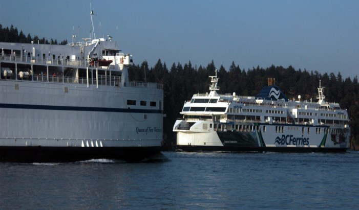
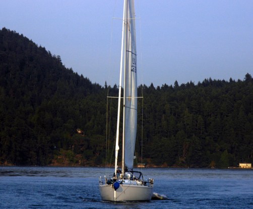
The straits between these islands were close, and heavily trafficked, and at one point a pair of huge ferries appeared to be on a collision course. They slipped past each other with perfect grace, giving us a spectacular show. I imagined that the din of their engines was a constant annoyance to the whales. Another close encounter yielded a great photo of a beautiful sailboat passing on our left.
However, the whales were first and foremost the main attraction. Here are the best shots I was able to bring home, using a borrowed Nikon D-80 and a 70-200 mm zoom telescopic lens. (The camera body belongs to our neighbor Lori. Thanks, Lori, for making these pictures happen!)
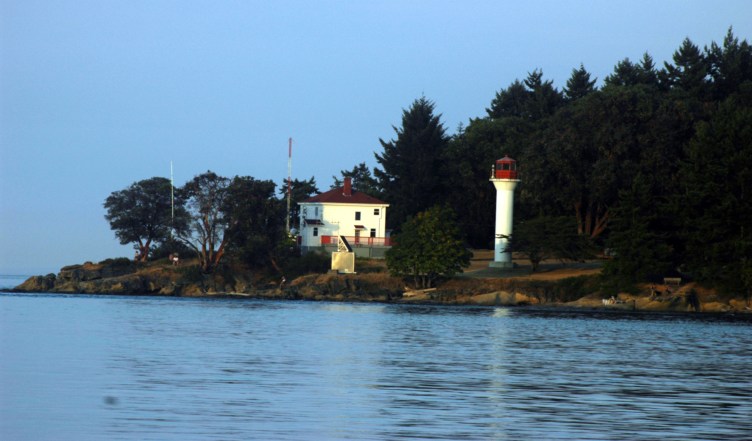
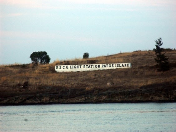
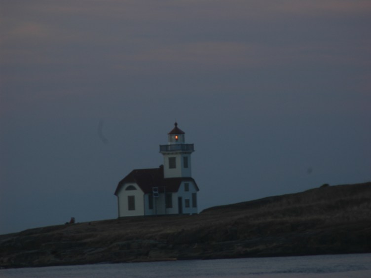
We had a considerable distance to travel as the sun got low, but our guides took the time to stop as they spotted sea lions swimming in the channel, and enjoying a late sunbath on some rock outcroppings ashore. The sunset was becoming spectacular, and the light it cast on a number of retired island light houses was splendid. We passed by the Patos Island light house, which was the last manned lighthouse in the United States when it was automated in 1974. We’ve heard that it is still occupied by volunteer hosts who provide tours in season. 🙂
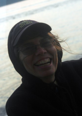
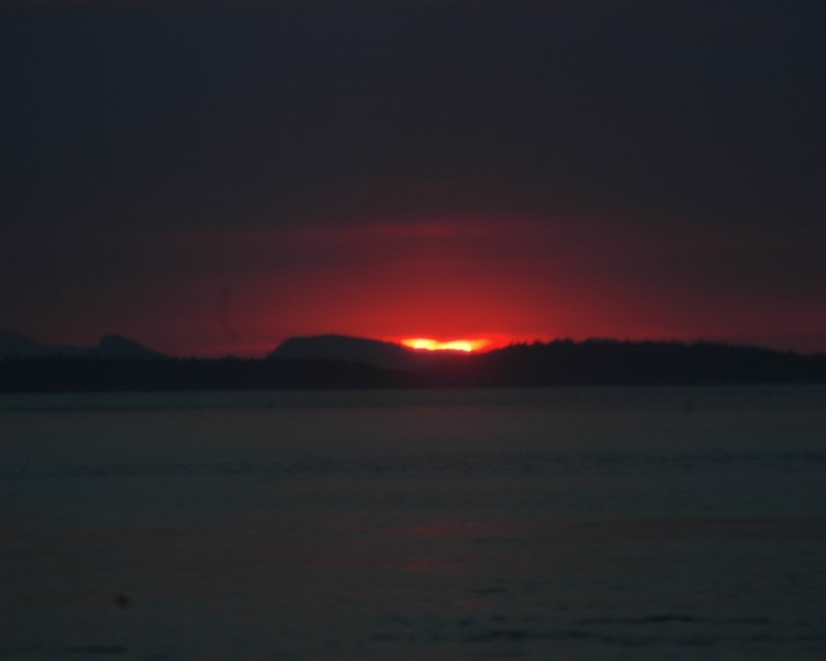
It was time to make tracks for our harbor at North Sound, and the guides sped south with the sun dancing with the wake. Ann gamely rode in the stern for the view, with the wind and spray, and so did I for most of the ride. The light shifted from golden to blood red as the boat throttled back into the no-wake zone leading into the channel at Smugglers’ Bay.
It was a perfect outing. We were so pleased with the cheerful professionalism of the guides, and the company of our boat-mates. A bit chilled, but happy with the day, we went looking for dinner.
Length: 9.17 miles. Time: 4 hours plus the time it takes to devour one dish of sorbet
Elliott and I completed the descent along Moran State Park’s Little Summit Trail from Mount Constitution to Cold Springs a couple of days ago, and it was by far the easiest (so far) of our hikes. It’s a mile and a half from the summit to the Cold Springs picnic area, where explorers can find a spring next to an old well.
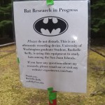
Bat research
There’s not much to see at Cold Springs–well, other than, you know, your typical enchanted green forest, mossy hillsides, and Mother Nature at her finest. There’s also a bat project there that Elliott’s been tangentially involved with. The area comes alive once people leave (or stop talking), with birds be-bopping around, squirrels chittering, and presumably bats doing their sonar thing.
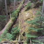
The next hike, a day or so later, I followed that same path but continued on downhill past Cold Springs, where the trail begins a
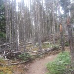
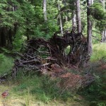
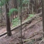
1972 windstorm
steep descent switchbacking toward Cascade Lake. Here is strong evidence of the windstorm that struck Moran State Park in 1972. Some of the upraised root structures look like nightmarish monsters. Unfortunately, since then, many of the second-growth Douglas fir trees have become infected with laminated root rot—perhaps as many as one in four trees, the rangers estimate. Part of that is also due to the stress the trees are under from the drought, as evidenced by the cascade of dry pine needles that descend on my head in a gentle breeze. A major cleanup effort in 2011 eliminated the worst cases of the root rot, but it is still prevalent. Thousands of western red cedar and
monster in the woods–can you see the eyes staring back?
lodgepole pine—native trees that are not as susceptible to root rot—have been started and will be transplanted to the areas hardest hit by the fungus.
One of the plants I was hoping to find was the phosphorescent fungus I remember from Girl Scout camp days. I found several fungi that looked similar, but since it was daylight I couldn’t quite tell if they were what I was looking for. Apparently, nearby Shaw Island is alive with bioluminescent critters, as shown in this (slightly reimaged) amazing photograph by Floris von Breugel.
A pileated woodpecker showed no concern as I traipsed along the path, nor did a squirrel happily munching a pinecone. I didn’t see any
Can you find the woodpecker?
deer, though their tracks were all around. I met a few hardy souls hiking up as I went down, and ran into them again as I was huffing and puffing uphill and they were sprinting down. But my plans to do this in the mornings in order to pick up litter at the lake before going on duty at 11 at the top have been moved to the category of “Dream on,” because that would entail hiking down in the dark, something not for my cautious feet.
I see a grumpy face in this one.1972 windstorm1972 windstorm
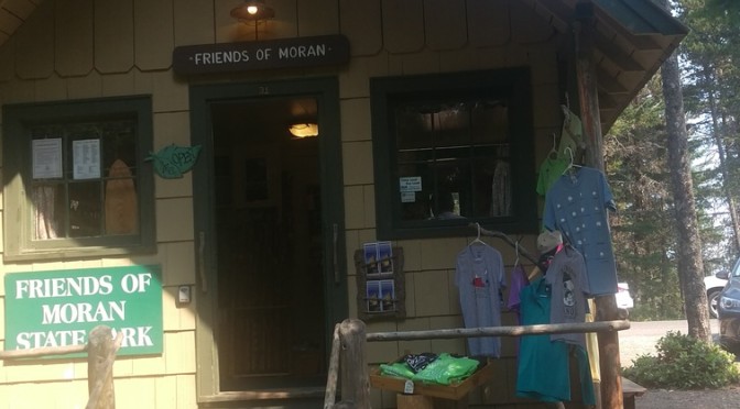
One of my jobs as a volunteer host is to fill in at the Summit Gift Shop, high atop Mt. Constitution and across the dead-end loop from the Summit Learning Center where Elliott and I spend our weekends. The gift shop is open daily, 11–4, and is the primary way the Friends of Moran State Park (FOM) earn funds, 100% of which go to helping the park and its volunteers.
My favorite t-shirt
The gift shop is two-room cabin located in an old 8’ x 10’ forestry shed built–like so many of the structures in the park–by the Civilian Conservation Corps in the 1930s. FOM sells a variety of souvenirs as well as chips, candy bars, and kettle corn from the building. Unlike most touristy sorts of venues that sell cheap kitsch, most of FOM’s are exclusive to the area and appropriate to a state park.
One of the best things about working in the gift shop is that I get to interact with the public–which, after a couple of days of being hermit-like in our RV and all of our nights of solitude, is a welcome relief. I like knowing where people are from, why they are here, and so forth. Perhaps that’s just another way of being snoopy, but chatting with visitors makes the day go by quickly.
The weather has been exceptionally warm (I wouldn’t go so far as to say hot, though some of the locals do) and dry, despite the little bit of drizzle we had a few days ago, and that means that we’ve had a larger number of visitors. Yesterday’s view of Mt. Baker was obscured by haze and rumors of a forest fire, but that didn’t seem to stop visitors from driving, biking, and hiking to the top.
The bicyclists are amazing, riding all the way to the top of a 4.7-mile incline from sea level to 2400 feet. Most drivers know to share the narrow two-lane road with bicyclists and are aware that a slower bicycle might be lurking around the next hairpin switchback, though we’ve seen a few drivers (and a few younger bicyclists) who seem oblivious to the dangers. Every once in a while a bicyclist takes a spill, usually while going downhill at excessive speeds (in my book, defined as over 12 mph, but I’m a chicken when it comes to high speeds on a two-wheeled vehicle).
Hikers are easily identified by footwear and sweat. Later today I plan on doing the hike to the bottom and back up again (the opposite of most hikers), so more details on that later.* Particularly impressive are the families–sometimes with kids as young as 8 or 10–who arrive at the summit still full of energy, racing each other to the top of the tower. Trail runners are particularly remarkable, as the loose stones, high roots, and fallen trees have to be taken into account. Some of them are training for the triathlon to be held here on Labor Day Weekend–and there will definitely be more about that later too.
* I hiked Mt. Constitution to Cascade Lake, bought a sorbet, and climbed back to the top by way of the Cold Springs trail–four hours, sore muscles, and a hole in my dirty, stinky socks…but I’m glad I did it.